
|
|
| |
|||

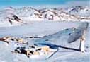
The sun photometer, located in the DMI hut at the TACAN site, is part of the AERONET (aerosol robotic network) program. AERONET is a federation of ground-based remote sensing aerosol networks established by NASA and LOA-PHOTONS (Centre National de la Recherche Scientifique) and is greatly expanded by collaborators from national agencies, institutes, universities, individual scientists, and partners. The program provides a long-term, continuous and readily accessible public domain database of aerosol optical, mircrophysical, and radiative properties for aerosol research and characterization, validation of satellite retrievals, and synergism with other databases. The network imposes standardization of instruments, calibration, processing and distribution. The AERONET collaboration provides globally distributed observations of spectral aerosol optical depth (AOD), inversion products, and precipitable water in diverse aerosol regimes. Aerosol optical depth data are computed for three data quality levels: Level 1.0 (unscreened), Level 1.5 (cloud-screened), and Level 2.0 (cloud-screened and quality-assured). Inversions, precipitable water, and other AOD-dependent products are derived from these levels and may implement additional quality checks. |
Wayne Newcomb |